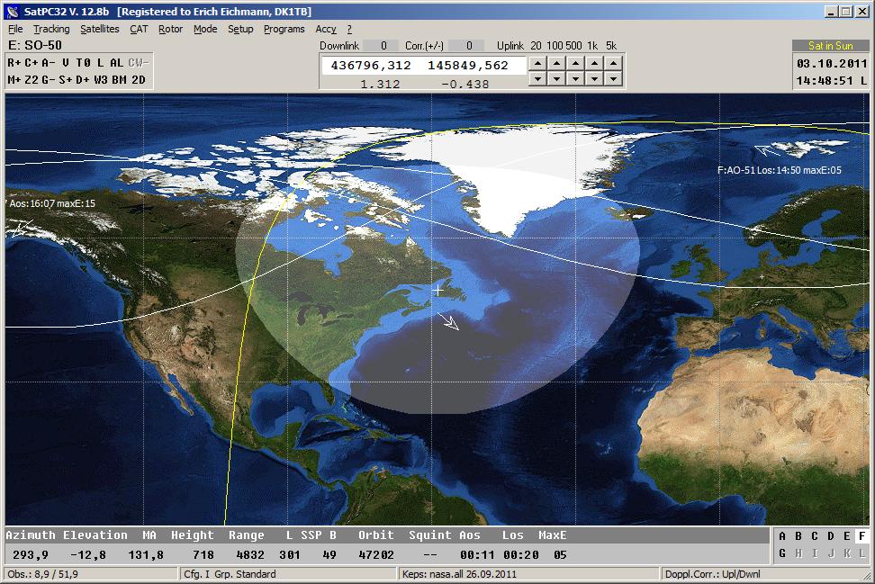
Screeshot of SO-50. The satellite allows FM QSOs with uplink on
VHF and downlink on UHF. The satellite requires a 74.4 Hz sub tone on the uplink
signal to be opened and 67.0 Hz sub tone on the uplink signal to be worked.
Both tones can be switched on/off via mouseclick on the control
"T0" (in the uppler left section of the program window).
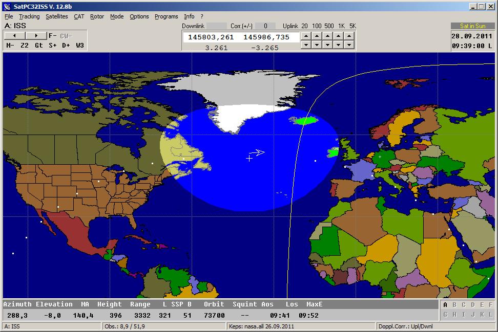
Screenshot of SatPC32ISS, a special program version for radio amateur operation
via the ISS. The program provides "In-Band" frequency control with several
radios. While "normal" amateur satellites use different bands for uplink and downlink both frequencies of the ISS are in the 2m band.
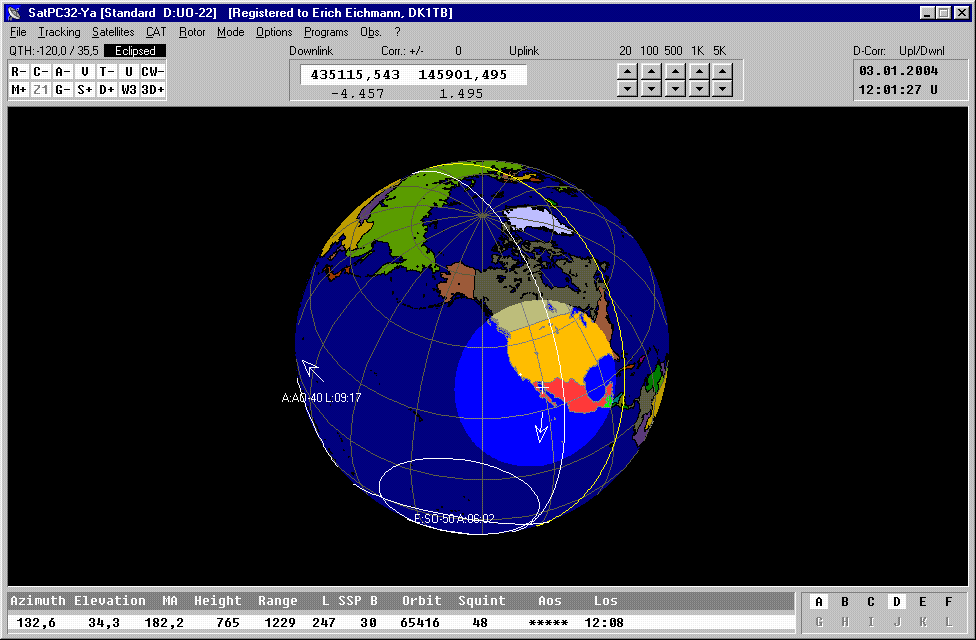
The screenshot shows a "BlueMarble" 3D-View worldmap. The 3D-view function supports all graphical features that can be chosen with the 2D-maps: Multiple satellites, Sun line, direction arrows, ground track of next orbit, Observer2-function, etc.). The Zoom2 feature, however, is not
supported.
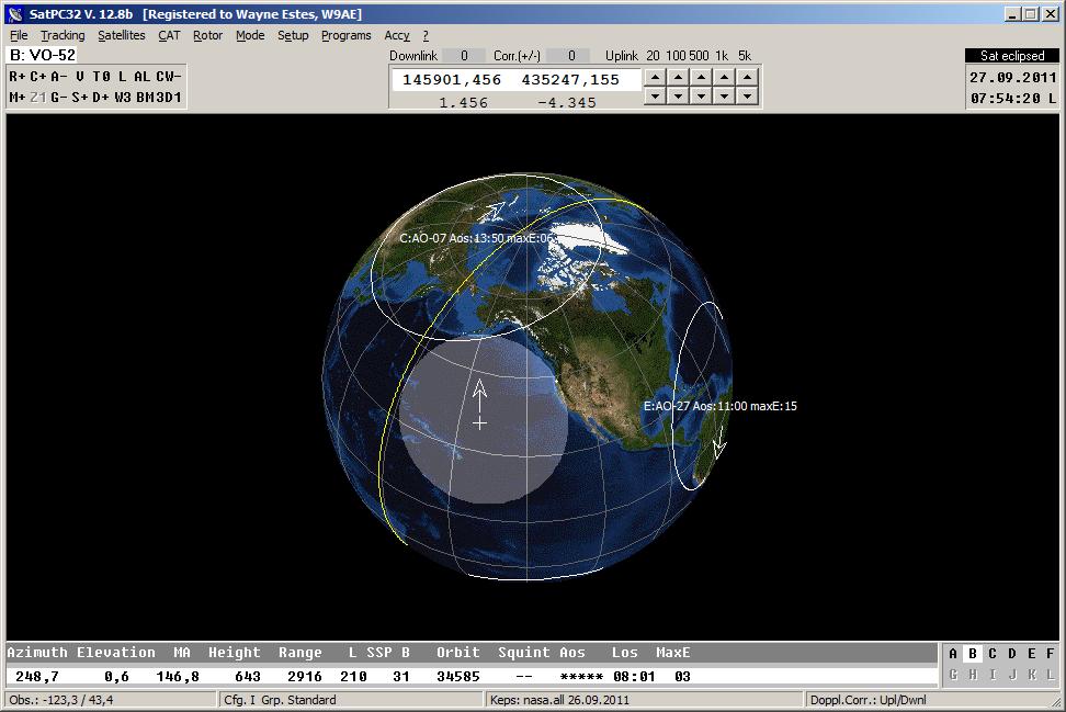
This older screenshot shows the footprint of UO22 and other satellites on a 3D-view world map. UO-22
is no longer operational. It allowed world wide 9K6 packet operation. To operate
such satellites SatPC32 can cooperate with Wisp32. Then SatPC32 will control the antennas and the radio while Wisp32 handles the data traffic. The (future) satellite Kiwisat will provide 9k6
packet.
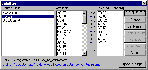
Menu 'Satellites' of SatPC32 . When a new
source file with Keplerian data is available, it will automatically be displayed in the left
list. Clicking on the filename will select the new file for further calculations.
The 2nd list shows the names of all satellites, for which
the file contains data.
The right list shows the selected satellites. Their positions
and rising and setting times will be calculated. The satellites marked with a '*' will be displayed in the world map. Clicking on a satellites name in
the 2. list will select it for the right list, clicking on the name in that list
will remove it from that list.
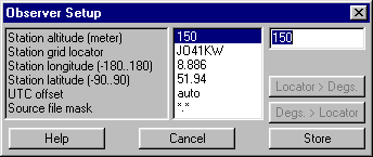
The screenshot shows the setup window for user data. The location can be entered either by longitude/latitude or the 6-digit locator.
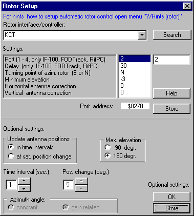
The screenshot shows the "Rotor Setup" window. All settings regarding rotor steering can be done in this window. All rotor interfaces/controllers supported by SatPC32 can be chosen from a list which opens when the user clicks the control left of the button "Search" in the upper section of the window.
The automatic rotor-control can update the antenna positions either
in equal intervals or after the satellites position (horizontal or vertical) has changed a certain amount of degrees. In the second case further
options are selectable. The horizontal angle can be either constant or variable in
dependence from the elevation of the satellite. (At a high elevation the
horizontal antenna angle becomes wider - when the antenna points to the zenith
the horizontal positioning is meaningless!).
With this option the programs increase the horizontal angle (corresponding
to a cosinus function), when the satellites elevation increases.
This feature reduces the horizontal antenna steps by almost 50% - without
loss of antenna gain.
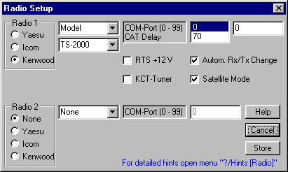
All settings regarding CAT steering (brand, model, CAT baudrate) can be done in the window "Radio Setup".
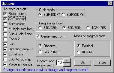
This screenshot shows the menu 'Options'. The user can select whether some of the most important options shall be on or off at program start. The "Zoom 1" world maps can be centered either on the satellite, the user's location or on Greenwich (longitude 0). Also, the user can choose 3 different
sizes for the program window. With the option 800 * 600, i.e., the program fills
the screen at a screen resolution of 800 * 600.
return